With a novel combination of a tracking unit and a communication platform, Jade University aims to make it easier to locate containers lost at sea in future.
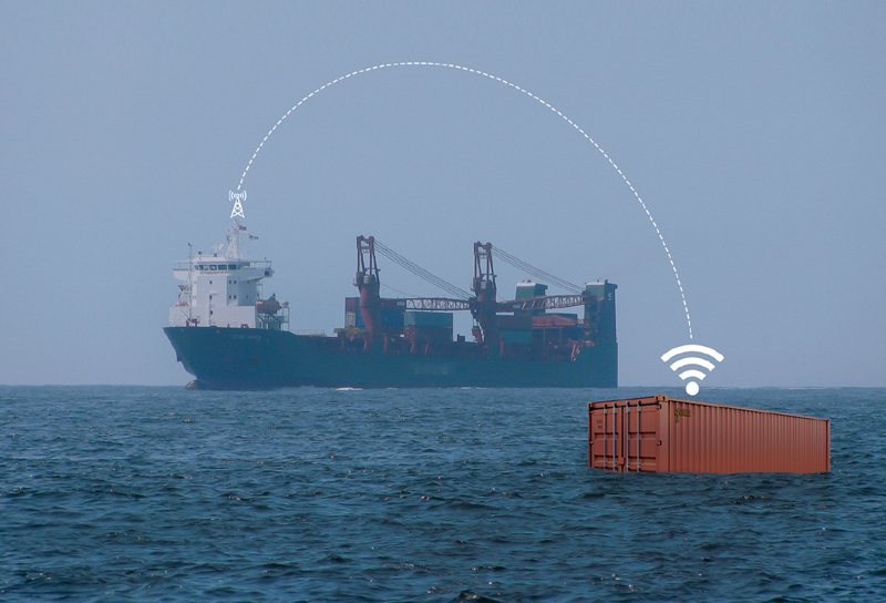
In order to make it easier to locate freight containers that have gone overboard in the future and to prevent scenarios like that of the “MSC Zoe”, Jade University and its partners (see info box) are currently developing an innovative tracking unit and a communication platform as part of the three-year “ConTAD – Smart Container Tracking and Accident Detection” research project. “Against the backdrop of increasing global trade and a further increase in shipping traffic, we can use our new system to help reduce the time it takes to detect containers that have gone overboard, increase environmental protection and improve the resilience of supply chains and the safety of shipping,” explained project manager Professor Christian Denker at the launch of “ConTAD” last November.
The device is a tracking unit, roughly the size of a smartphone, attached to the container door. It consists of an antenna, a warning light, a solar cell and a floatation device. “We’re currently working with our partner Eurogate to test exactly how big the tracking unit will be and what type of line connection it’ll have with the box,” explained Moritz Oberjatzas, who is supervising the project as a research assistant. The tracking unit works on the same principle as a smartwatch. This means that vibration and acceleration sensors will be used to recognise when a container has gone overboard. In addition, satellite navigation will be used to send the necessary information to the damaged vessel, to ships in the vicinity, to the cargo owner and to the damage experts responsible – with the corresponding coordinates. “In the event of an accident, the aim is for the batteries in the tracking unit to have a service life of two years, thanks to the use of solar cells, and to send a signal from the water surface for at least four days,” he continued.
“As the system utilises existing communication systems already available to the shipping industry, ‘ConTAD’ requires no additional infrastructure to be implemented on board ships. This means the hurdles for a market launch are low,” said Denker optimistically. Tests on the system’s efficiency and suitability for everyday use will continue until October 2026. (bre)
INFO
Contad
The Federal Ministry for Economic Affairs and Climate Action’s Maritime Funding Programme is funding “ConTAD” to the tune of 1.4 million euros, of which roughly 470,000 euros is allocated to Jade University. Cooperation partners are Socratec Telematic and Brehmer. Associated partners include Hapag-Lloyd, Eurogate Container Terminal Bremerhaven, Neue Schleppdampfschiffsreederei Louis Meyer, m2m Germany and the Maritime Cluster Northern Germany.

